Mt. Ararat (Agri Dagi) in Turkey
info
Practical information, 2003
CZ / 2003 - pro české žadatele o povolení: Při letošním pokusu /léto 2003/ o získání povolení ja turecké ambasádě v Praze jsme neuspěli. Po několikerém přepisování formulářů jsme nakonec ustrnuli na mrtvém bodě. Pro případně zájemce adresa tureckého velvyslanectví je: Na Ořechovce 69, Praha-Dejvice, tel.: 224311402/403, z Hradčanské 4 stanice BUSem 216 nebo z Dejvické tramvají 3 stanice a kousek pěšky
[Dodatek] Začátkem září jsme povolení získali, bohužel až po plánovaném termínu odletu, zrušení letenek a v realizaci alternativního programu. Důležité ale je, že to jde ! Good Luck.
| The requirements for climbing permits changes weekly to monthly. In 2001 reports that a permit is needed from the south approaches and not needed from the north and west approaches. It is suggested that the climber should obtain a passport for a 3 month stay in Turkey. |
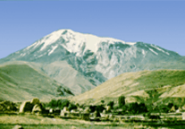
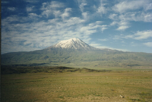
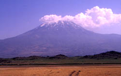
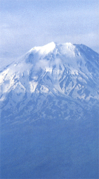
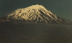
Mount Agri / Ararat, an inactive volcano at the borders of Turkey and Iran covered by a snow cap up to 5137 meters. It is located ten miles west of Iran, and 20 miles south of Armenia. Southwest of the mountain there is the Little Mount Agri (Ararat) reaching up to 3896 meters (12,877 ft). Serdarbulak is a lava plateau in 2600 m and stretches out between them. In the Old Testament Little Agri (/Mt.Agri?) is the place where Noah's Ark came to rest after the great flood.
 Ararat has no crater, and no eruption has ever
been recorded. However, an earthquake rocked the mountain in 1840, burying a chapel,
convent, and village that had previously occupied the slopes. Today Nomadic Kurds reside
on the mountain, migrating between the valleys and high pastures with their herds of
cattle and sheep.
Ararat has no crater, and no eruption has ever
been recorded. However, an earthquake rocked the mountain in 1840, burying a chapel,
convent, and village that had previously occupied the slopes. Today Nomadic Kurds reside
on the mountain, migrating between the valleys and high pastures with their herds of
cattle and sheep.
The weather in the summer in the area is sunny, warm and dry. However, in the winter and spring, cold and harsh conditions prevail, and mountain climbers occasionally face blizzards and turbulent weather. Summer (July, August and September) is the best term to climb up around . The southern side is the easiest and safest way to climb to the summit. There is a best transpot acces from this side too.
At present the upper third of the mountain is covered with snow all the time, the last hundred meters of snow at the top have turned to ice. Fresh running water is available after the sun has been up a while to melt the snow. Below the snow the slopes are covered with great blocks of black basalt rock, some as large as village houses.
It has been closed for many years because of the civil war between the Kurds and Turks.
https://www.peakbagging.com/Turkey/AraratReport.html
More about Eastern Anatolia available at https://www.turkishtravel.com/eastern01.htm
Also see article about history of Ark searching https://arksearch.com/naexped.htm
See Project von Bora with esoteric photos of alleged Ark on https://www.vonbora.com/project.html
Getting There
Trabzon-Erzurum-Iran International Transit Highway. Dogubeyazit, 270 km from Erzurum and
nearby Igdir, the two closest towns to the mountain, are located on this route. Planes,
trains, and buses connect Erzurum with Ankara.
Go to Istanbul then to Ankara then to Erzarum by bus and go from Erzurum to Dogubayazit
which takes about 4 and 1/2 hours. Cars or vans can be rented in Dogubayazit.
Turkey map

Regional Attractions
https://www.naturekey.com/home.html
 The area surrounding Agri has retained its natural beauty. The local
population still engages in a traditional life styles. In the summer months the villagers
move to the yayla, the summer pastures, to find fresh grazing for their herds of sheep,
goats, cattle and horses. Women continue to weave carpets and kilims in time honored
designs; Village of Ortulu is particularly renowned as a center of beautiful handicrafts.
Other nearby tourist attractions include the Ishakpasha Palace, a fabulous 18th century
castle of a local potentate, and the meteor hole near the Iranian border.
The area surrounding Agri has retained its natural beauty. The local
population still engages in a traditional life styles. In the summer months the villagers
move to the yayla, the summer pastures, to find fresh grazing for their herds of sheep,
goats, cattle and horses. Women continue to weave carpets and kilims in time honored
designs; Village of Ortulu is particularly renowned as a center of beautiful handicrafts.
Other nearby tourist attractions include the Ishakpasha Palace, a fabulous 18th century
castle of a local potentate, and the meteor hole near the Iranian border.
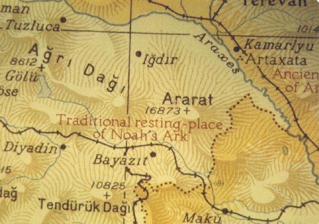
Near surroundings of Mt.Ararat map

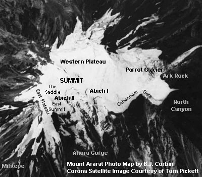
Mt. Ararat - Satellite image with larger glaciation (click for detatil)


Summit satellite photo